
ASHBA Map and Region Listing
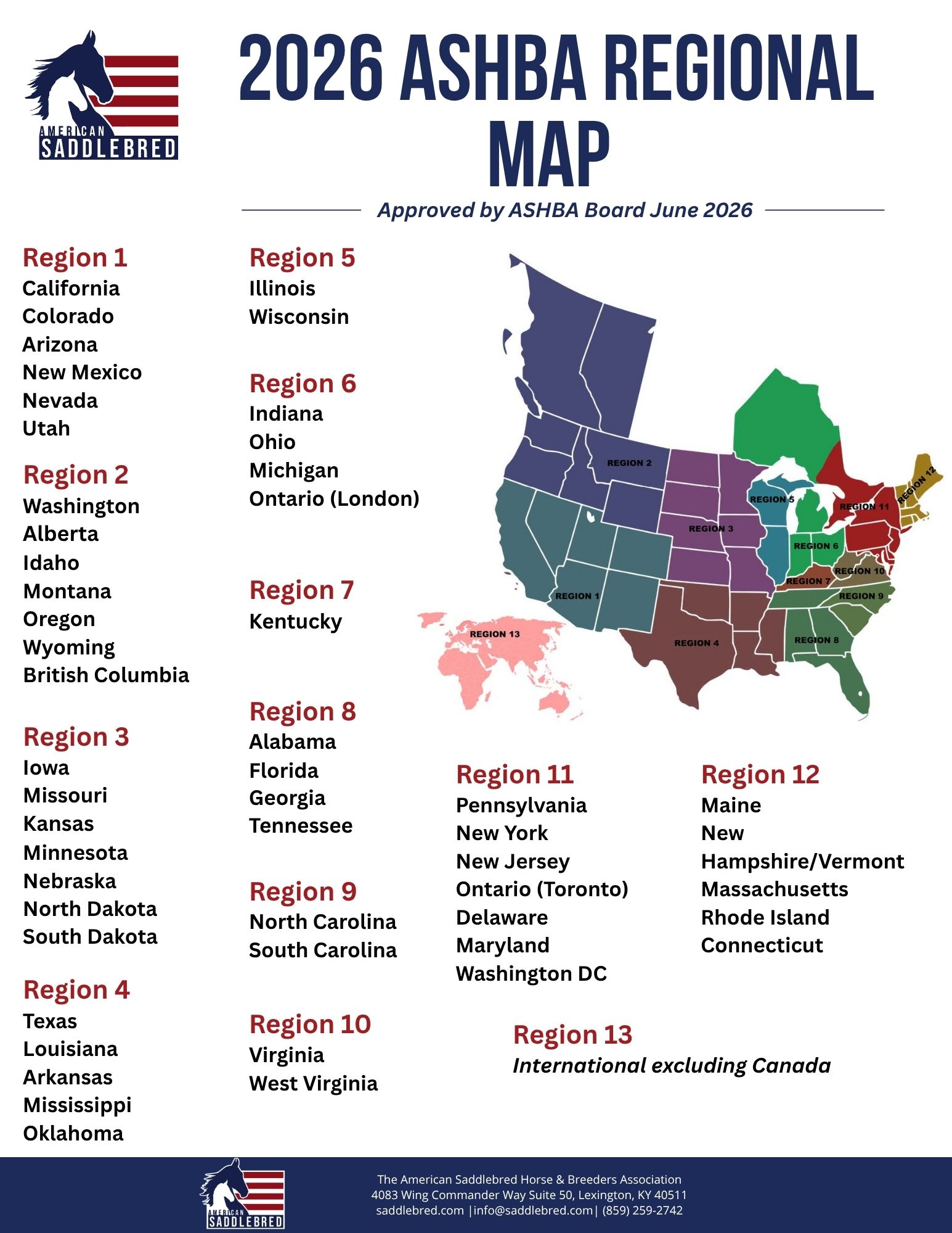
The ASHBA Regional Map is designed to provide a clear, comprehensive view of all geographic areas served by ASHBA. This interactive resource visually represents each region, ensuring that members, organizers, and stakeholders can easily identify the full scope of ASHBA’s reach and activity.
The map plays a key role in supporting the organization’s mission by helping to accurately track and record horse shows within each region. By organizing events geographically, it promotes better coordination, improves visibility for regional activities, and ensures that data is consistent and up to date across the entire network.
In addition, the ASHBA Regional Map helps evaluate regional coverage to ensure that all areas are being appropriately served. By identifying gaps, overlaps, or underserved locations, it provides valuable insight for future planning, growth, and resource allocation. This enables ASHBA to maintain balance and fairness in representation while fostering opportunities for participation in every region.
Whether you are looking to find shows near you, understand regional boundaries, or support strategic decision-making, the ASHBA Regional Map is an essential tool for keeping the community connected, informed, and equitably supported.